PrettyMap - World Atlas and Maps, GPS 5.5
Free Trial Version
Publisher Description
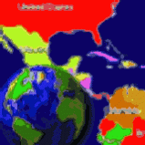
View maps of Earth and other planets with PrettyMap! See current day and night regions, learn geography by taking the quiz, enjoy 3D elevation surfaces, measure distances between locations and create your own maps with special places! PrettyMap lets you view vector and raster maps and images (such as country boundaries, world cities, rivers, satellite photos), search in geographically-referenced data, visualize and analyze spatial information, download current weather reports and forecasts, extend your knowledge by taking an educational quiz, and edit your own simple maps. PrettyMap is a GIS program with the following features:
- support for vector maps (points, lines, areas)
- support for raster maps (terrain elevation and bathymetry, images, symbolic)
- displays maps of various planets
- supports GPS, logging GPS locations, wardriving and the "follow GPS" mode
- GPS fleet tracking service: PrettyMap can regularly report locations so that you know where your fleet is, and others know where you are
- displays current weather maps, detailed weather reports and forecasts (requires Internet connection)
- all maps are free:
- political: country boundaries with country names, capitals, population sizes, ...
- comprehensive set of data for each country, based on the current information from The World Factbook
- elevation data for Earth, Moon, Mars
- lunar mountains, craters and crater chains, seas, lakes, swamps, valleys, ...
- spherical projection
- relief and 3D elevation (DEM) view with vector map overlay
- shows day and night regions, shadow length and sun/north orientation
- zoom range from whole planet to meters
- multiple, configurable vector map layers
- data search for vector map databases
- versatile quiz with teacher mode
- bar charts and color-by option
- distance measurement
- integrated user-defined locations (Points Of Interest) editor, stores notes and values for each POI
- sessions to quickly save/restore program state
About PrettyMap - World Atlas and Maps, GPS
PrettyMap - World Atlas and Maps, GPS is a free trial software published in the Geography list of programs, part of Education.
This Geography program is available in English. It was last updated on 23 April, 2024. PrettyMap - World Atlas and Maps, GPS is compatible with the following operating systems: Other.
The company that develops PrettyMap - World Atlas and Maps, GPS is Mooncoder. The latest version released by its developer is 5.5. This version was rated by 1 users of our site and has an average rating of 5.0.
The download we have available for PrettyMap - World Atlas and Maps, GPS has a file size of 5.24 MB. Just click the green Download button above to start the downloading process. The program is listed on our website since 2008-11-24 and was downloaded 321 times. We have already checked if the download link is safe, however for your own protection we recommend that you scan the downloaded software with your antivirus. Your antivirus may detect the PrettyMap - World Atlas and Maps, GPS as malware if the download link is broken.
How to install PrettyMap - World Atlas and Maps, GPS on your Windows device:
- Click on the Download button on our website. This will start the download from the website of the developer.
- Once the PrettyMap - World Atlas and Maps, GPS is downloaded click on it to start the setup process (assuming you are on a desktop computer).
- When the installation is finished you should be able to see and run the program.
